


 69 / 71


perance
Kelly
L.
ent
.
RiceL.
Pigeon
R.
Devil Fish
Greenwood
L.
L.
Tom
L.
Swamp
L.
Brule
R.
E.
Pike
L.
Trout
L.
Devil
TrackL.
Two IslandL.
Elbow
PineL.
Kemo
L.
L.
Brule
South
Brule
GaskinL.
WinchellL.
SwanL.
Deer
Yard
Caribou
Pike
ClaraL.
Lichen
WhitePineL.
L.
L.
L.
L.
PoplarR.
R.
Cas
cade
Jack
Homer
Pipe
Cascade
L.
L.
L.
L.
L.
und
Snipe
Long
IslandL.
L.
.
DavisL.
ConeL.
VernonL.
Crystal
L.
Fowl
L.
So.
Watab L.
Fowl
L.
L.
Alder
L.
TwinL.
TaitL.
PAT BAYLE
STATE
FOREST
GRAND PORTAGE
STATE FOREST
Temperance River State Park
Kadunce River
Wayside
Judge
C. R. Magney
State Park
Grand Portage
State Park
Eagle Mt.
GUNFLINT TRAIL
ARROWHEAD
TRAIL
MN Highest Pt.
GUNFLINT TRAIL SCENIC BYWAY
CARIBOU TRAIL
SCENIC BYWAY
MOON TRAIL
Loon L.
Gunint L.
BanadadL.
Brule L.
McFarland
Pine
W.
Pike
Clearwater
Daniels
L.
L.
L.
L.
L.
Bearskin
Flour
L.
L.
L.
Rose
Northern
Light
L.
BirchL.
PoplarL.
MeedsL. CaribouL.
South L.
IronL.
ld
Grand Marais
Mineral Center
Hovland
Croftville
ofte
Lutsen
Red
Cliff
Grand
Portage
6 1
17
7
8
12
4
GRAND PORTAGE
INDIAN RESERVATION
EL.1660
EL.2230
EL. 2301
EL. 2238
EL. 2169
EL. 1254
Misquah Hills
Lima Mt.
Farquhar
Peak
6 1
61
593
bor
roeder
Gunflint Ranger Station
Horseshoe Bay
MINNESOTA
CANADA
Grand Portage
Nat’l Monument
Border Open 24 Hrs
Cascade River
Ray Berglund
Wayside
State Park
ver Wayside
Tofte Ranger Station
Ski Hill Road
Cut Face Creek Rest Area
Onion
River
Road
The Grade
SEASONAL REST AREA—
RESTROOMS
YEAR-ROUND REST
AREA—RESTROOMS
WAYSIDE—NO
RESTROOM
STATE PARK
CAMPGROUND
SEASONAL VISITOR
CENTER
YEAR-ROUND VISITOR
CENTER
PUBLIC BOAT LAUNCH
N
S
W E
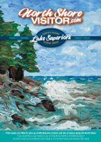
NorthShoreVisitor.com©NinaWorks!
Do not reprint or
re-use without
permission
“Your best link to the North Shore” National Geographic Traveler From Duluth’s Canal Park, northeast for 154 miles to Grand Portage and the border with Canada, this singular drive is a voyage through some of America’s most unspoiled lands. Your route offers breathtaking views, endless opportunities to enjoy nature, historic sites, attractions, parks, and villages with events, shopping, lodging, dining and local culture. The path hugs the water’s edge along the inland coast of the world’s largest freshwater lake, bisecting the shore and the ancient inland rock formations and wooded hills rising above the coast. The North Shore Scenic Drive was recognized for the outstanding scenic and recreational opportunities it provides along the touted North Shore of Lake Superior and was designated as an All-American Road, Minnesota’s only such designation. Learn about this and other scenic byways, (Duluth Skyline Drive, Superior National Forest Scenic Byway & Gunflint Trail) at NorthShoreVisitor.com/byways.NORTH SHORE
SCENIC DRIVE
OR HIGHWAY 61 FOR SHORT
NorthShoreVisitor.com